York Association of the National Trust


Walks 2017

YANT Walks 2017

Walks Organiser:  walks@yant.org.uk

Thursday 28th December, 2017
'A stroll around the University'
Approx. 4 miles.

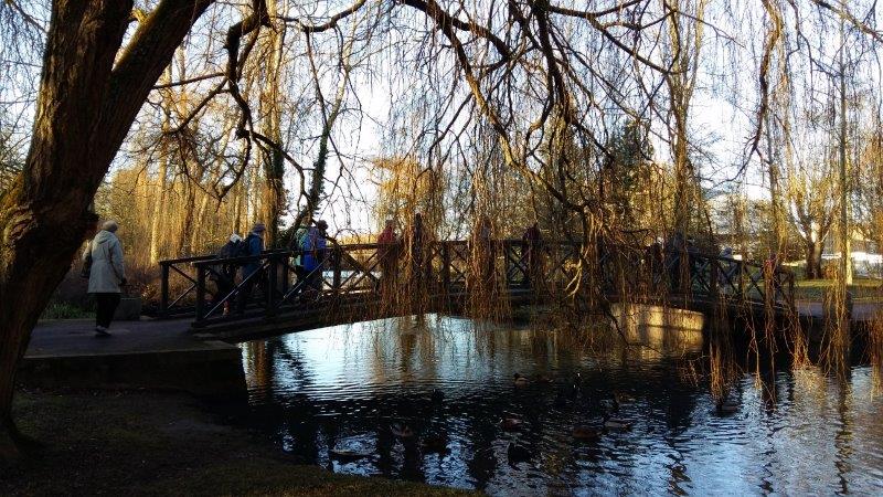
Our last walk of the year!


"It was a lovely sunny day and interesting to walk around some of the newer parts of the campus in addition to the long-established area around Heslington Hall and the lake."


An easy walk with no stiles or hills, which gave us a chance to enjoy some fresh air and exercise amid the Christmas/New Year festivities.

Meet at the gates of Heslington Hall for a 10am start.

NB. Parking there is not easy but the no. 66 bus (frequent service) stops opposite the Hall.


Leader: Joyce Costello


Thursday 2nd November, 2017
A guided walk to see York’s flood defences
Approx. 4.5 miles.
'A great walk along the Ouse Flood Defences with superb explanation of what these do and how the future plans are likely to affect the City of York. Led by Andy Burnard'
The walk starts from Blue Bridge at the junctions of the rivers Foss and Ouse. Meet there at 10am. Either leave your car at Rawcliffe Bar Park and Ride and take the No. 2 bus into town or park in St George’s field car park. We observe the Foss Barrier works, then walk along the north side of the Ouse, cross Ouse Bridge and walk to Scarborough railway bridge. We cross the railway bridge and walk along the north bank of the river to Clifton Ings, then follow the flood bank next to the river and under the Ring Road to the Riverside Farm pub for (optional) lunch. From the pub it is a short walk along the A19 to Rawcliffe Bar Park and Ride, for car or bus as appropriate.

The walk is level, with good surfaces and no stiles. During the walk the leader will describe the various types of flood defences seen, and the principles of their operation.

Leader: Andy Burnard
Three photographs courtesy of G. Mortimer

Tuesday 10th October, 2017
Appleton Roebuck
Distance 3.5 miles.

An easy circular walk, via Holme Green, along good tracks and minor roads with 3 stiles.


The walkstarted at 10am outside the Roebuck Inn. Parking available at the roadside in the village.


To reach Appleton Roebuck turn off the A64 at Bilbrough Top Services and follow the signs for Appleton Roebuck.


Lunch was available at the pub and at the services at Bilbrough.


Wednesday 13th September, 2017
Hole of Horcum, Blakey Topping and Marlow Cross
The walk started at Saltergate Brow car park, opposite the Hole of Horcum, at 10.30 am. Toilets and pre-booking of lunch were available at the Fox and Rabbit Pub on the Whitby/Pickering road at 10.15 am.

The walk crossed Moor and farmland (in the opposite direction to the Hole of Horcum), and was easy apart from one optional steep climb. The heather is usually in flower in September.


Saturday 9th September, 2017
North Stainley to Masham along the Ripon Rowel
Distance 8 miles.
The walk started at North Stainley and followed the Ripon Rowel route through the pretty villages of Mickley and West Tanfield with it’s 13th century church and 15th century Marmion Tower. We followed the River Ure through the ‘beautiful wilderness’ of Hackfall, an ancient woodland designed by William Aislabie and recently restored to its Victorian splendour.

The walk ended at Masham where a ham salad and apple pie/trifle tea had been prepared by the WI.

The path is undulating in places with some gentle ascents in the woodland, but no stiles.

Tuesday 15th August, 2017
A walk at Fountains Abbey and Studley Royal
Approx. 5 miles.

The walk follows the ancient Abbey walls around the perimeter of the Fountains Abbey estate, passing Hill House Farm then on through fields and woods to Studley Royal Deer Park. Continuing through Studley Royal Water Gardens and Mackershaw Park we finish at the ruins of Fountains Abbey.


Saturday 22nd July, 2017
Coverdale/Wensleydale
Distance 8 miles.
A walk in the Coverdale/Wensleydale area starting on Middleham Upper Gallops just below Penhill, then via the River Cover, Cover Bridge and alongside the Ure, ending at Jervaulx. A mixture of country and riverside tracks, mainly downhill and level, covering 8 miles. Tea at East Witton WI.

Tuesday 11th July, 2017
Beningbrough woods and the River Ouse
Approx. 4 miles.
Meet at the main car park at Beningbrough Hall for a 10am start. The walk commences along a path past the Farm Shop and through fields, before following the left bank of the Ouse to Newton-on-Ouse. Crossing the entrance drive to Beningbrough Hall it continues through woods and along field edges, circling Pike Pond, before arriving back at the car park. Throughout the walk there are distant views of the Hall, some of them to be seen through frames at intervals. Many birds should be seen and heard and there may be Mandarin ducks on the river. The walking is easy; there are no stiles and it should not be muddy unless there has been heavy rain. However, it will be necessary to tread carefully to avoid exposed tree roots along the river path.

Saturday 17th June, 2017
Coastal walk to Saltburn
Distance 8 miles.
This coastal walk starts near Boulby Cliffs, at 666 feet the highest cliffs in England, and passes the Industrial Heritage sites of Loftus Alum Quarries (NT) and Skinningrove 'Valley of Steel' before arriving at the Victorian seaside resort of Saltburn. The path follows the cliff top, with excellent views along the coast and, although fairly flat for the most part, has some steepish flights of steps in places and is considered moderate in difficulty.
Saltburn WI provided tea.

Thursday 8th June, 2017
Marton-cum-Grafton
Distance 4 miles.
The walk starts in Grafton at 1O am. We go up Thorney Hill Lane and turn right onto the Grafton Hills, which have dramatic views. We then enter Marton, past Ye Olde Punch Bowl Inn, then along Reas Lane and across recently ploughed fields, as far as Grassgills. We continue across more fields to Moor Lane and follow this until we turn right past Marton Cottage Farm then go along Legram Lane returning to Marton, past the church. A different return route takes us past the trig point, at 75 metres above sea level, again with wide views, before rejoining Thorney Hill Lane. Along the route we need to pass under an electrified fence and cross one ditch on reaching Moor Lane (this could be tricky if wet).

To reach the start of the walk, take the A59 from York, then the B6265 towards Boroughbridge. Take the left turn, signed Grafton, opposite Grafton Lodge, about a mile beyond the junction with the road from Great Ouseburn. Park on the hill descending into the village; there is a display board and post box near the bottom of the hill

Saturday 22nd April, 2017
Huddersfield Narrow Canal
Distance 7 miles.
We start our season of full-day walks with an easy walk along the canal towpath from Huddersfield to Standedge Tunnel, with time to look around the Visitor Centre there. Tea will be at the Visitor Centre.

If time permits there will be an opportunity to take a short boat trip into the tunnel (fare payable locally).

Subject to weather, good walking shoes will be acceptable.

Share by: